Barbican Theatre London
Barbican Theatre Tickets

What’s On at Barbican Theatre
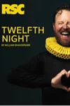
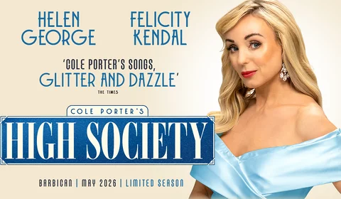
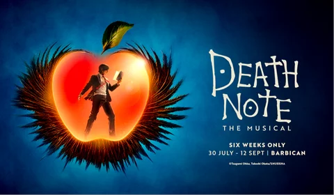
The Barbican Theatre events schedule is an eclectic mix of classical music, film screenings, talks and theatre, including an annual season of drama from the Royal Shakespeare Company - new events to be announced later this year. The Barbican's other big season is during the summer, when classic musicals and star-studded dramas bring in crowds. In 2026, the summer shows are Death Note: The Musical, based on the internationally bestselling manga series, and Cole Porter's dazzling, toe-tapping classic - High Society musical, starring Felicity Kendal and Helen George. This Golden Age comedy about wedding plans that descend into chaos is bubbly, feel-good entertainment perfect for the warmer months. Don’t wait to RSVP, book your spot in the audience now!
About the Barbican Theatre
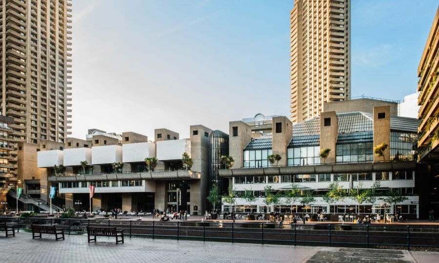
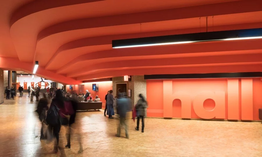
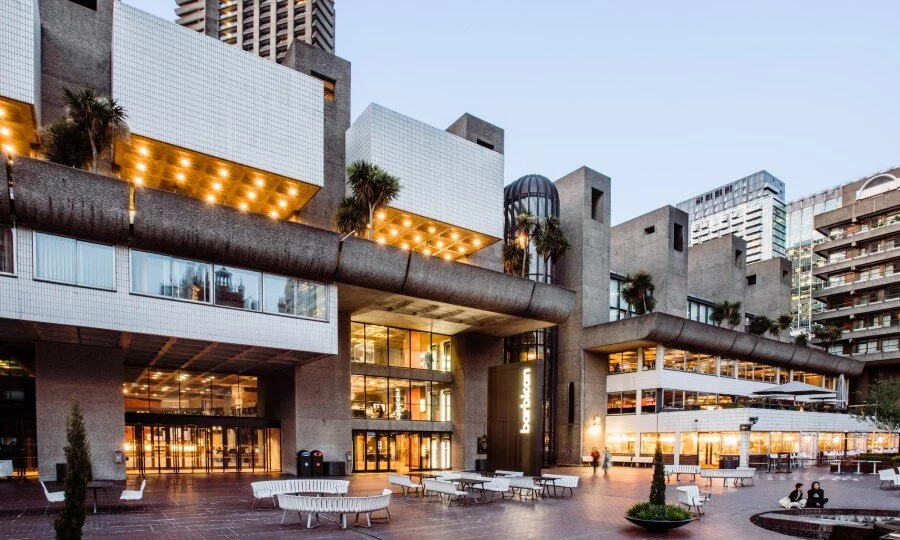
The Barbican Theatre opened in 1982 as part of the overall Barbican Centre complex, the largest performing arts centre in Europe. The Barbican Theatre carries the same brutalist architectural style of the rest of the Centre, which hosts a huge range of entertainment throughout the year including classical music concerts, live musicians, theatre shows, film screenings and art exhibitions. The Theatre itself has a capacity of 1,156 and was designed by the Royal Shakespeare Company (RSC) to host their own London productions, which are often transfers from The Royal Shakespeare Theatre in Stratford-Upon-Avon, Shakespeare's own hometown. The Barbican is now owned by the City of London corporation.
Many UK and international productions have been hosted by the theatre, which provides an eclectic mix of shows across each theatrical season. Some recent notable examples include the 2019 production of Jesus Christ Superstar , which transferred from Regent's Park Open Air Theatre and Hamlet starring Benedict Cumberbatch in the title role, which broke records to become the fastest-selling event in London Theatre history.
In July 2021, after theatres had been closed for over a year due to the COVID pandemic, The Barbican Theatre reopened with a hugely successful revival of Anything Goes featuring Broadway superstar Sutton Foster.
Should I get there early?
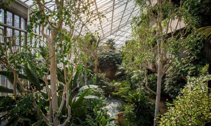
There’s plenty to do at the Barbican if you have time to kill ahead of a show with art galleries, gift shops, a library and even a conservatory available within the building, as well as plenty of bars and cafes. The Conservatory has around 1,500 species of plants and trees, including rare and endangered plants, as well as pools that are home to koi fish and carp. You can enjoy outdoor seating in summer, or chill out inside of the centre itself for as long as you need, with lots of low-cost activities available - the art exhibitions throughout the building are often free, and change seasonally. You can also take a Barbican Centre tour to learn about iconic Brutalist building's legacy on the architecture of London.
Map and Address
Silk Street, London, EC2Y 8DS
Rail: Liverpool Street Station is the closest major railway station, a 15-minute walk away. Farringdon station is around a 10-minute walk away.
Tube: Barbican tube station, served by the Hamersmith and City, Metropolitan, and Circle lines, is around a 5-minute walk from the Silk Street entrance of the Barbican Centre. Moorgate, on the Hammersmith & City, Metropolitan, Circle, and Northern lines, and Farringdon, on the Elizabeth line, are around a 10-minute walk from the theatre. St Paul's station, on the Central line, is slightly further away - around 15 minutes’ walk from the Silk Street entrance.
Bus: Route 153 stops closest to the entrance to the Barbican Centre. Routes 4 and 56 also stop close by at Barbican tube station.
Car: The Barbican has on-site parking. Free Blue Badge parking can be booked through the venue up to three months ahead of your visit. Drop-offs are possible outside the Silk Street entrance.
Nearby Attractions
The Barbican Centre itself offers a range of attractions to explore. There are often free exhibitions across the different public spaces in the Centre, and a range of tours are held throughout the year. The public library is open to all on the 2nd floor. The Barbican Conservatory is the second biggest conservatory in London; entrance is ticketed, but free.
The Barbican has a range of bars, cafes, and restaurants open throughout the day, offering a range of options for food and drink. The surrounding area is also home to a range of renowned pubs and restaurants if you’re looking for something ahead of a visit to the theatre.
If you have a little more time to spare ahead of your visit, the surrounding area is home to some of the most historic sites in the City. Sections of the Roman city wall are visible nearby, and Guildhall (around a 10-minute walk away) houses a Roman amphitheatre and an art gallery, both accessible for free. St Paul’s Cathedral is around a 15-minute walk from the Barbican.

Frequently Asked Questions
What time does the Barbican Theatre box office open and how do I collect tickets?
The box office opens 90 minutes before performances. Tickets can be purchased in person from the Barbican Centre Shop between 10am - 9pm (Monday-Saturday) and 12pm - 8pm (Sunday). We recommend patrons arrive as early as possible to avoid queues and allow enough time to enter the auditorium. Please ensure to bring your confirmation email and your ID.
What time does the Barbican Theatre open for a show?
The theatre opens around one hour before the show starts. The Barbican Centre complex is open from 9am (Monday to Saturday) and 11am (Sunday). This is a very unique building that is well worth exploring before a show - take a look at the rooftop conservatory with greenhouse plants, or sit outside and admire the architecture in the summer months.
What food and drink are available at the Barbican Theatre?
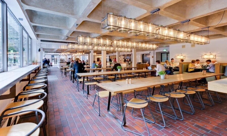
There are several places to eat and drink, from a quick coffee (Barbican Kitchen) and a tasty burger (Bonfire), to martini bars and fine dining establishments (Osteria).
Does the Barbican Theatre have a cloakroom?
A free cloakroom service is available for ticket-holders, from 90 minutes before the show starts until 30 minutes after the performance has ended. Patrons are encouraged to make a £2 donation in order to support the centre's charitable efforts.
Is the Barbican Theatre air-conditioned?
Yes, the theatre is fully air-conditioned and is very comfortable in the summer months.
Where should I eat near the Barbican Theatre?
Although the venue is a great place to grab a bite to eat before a show, there are also many restaurants in the nearby area. Côte Brasserie, which is just a 5 minute walk from the theatre and specialises in French cuisine, offers an excellent pre-theatre menu.
What is the best hotel to stay at near the Barbican Theatre?
Citadines, an apart-hotel that is just a 10-minute walk from the theatre is a good choice for those not looking to break the bank. Alternatively, if you're coming to the venue for a special occasion, why not stay at the luxury Montcalm at the Brewery London City hotel, which is less than a five-minute walk from the theatre.
How do I contact the box office?
The box office can be contacted by emailing tickets@barbican.org.uk.